Next time you are out by the St Austell and Par rivers, look out for WRT’s interpretation boards!
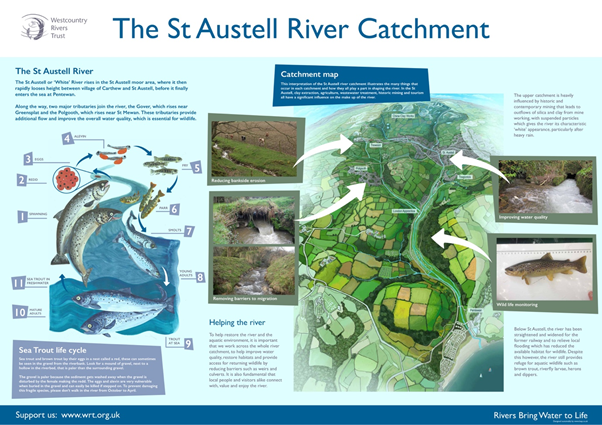
An important element of our South Cornwall River Improvement Project (SCRIP) is to engage and provide information to those people who live in and visit the catchment on a regular basis. The Rivers of the St Austell bay have a fascinating history and have gone through huge changes due to historic and more recent mining activities and the industrial revolution.
These interpretation boards provide opportunities to communicate some the of issues that local rivers face, such as barriers to fish migration, diffuse pollution, river bank modification and water quality issues from mining works. They also show how organisations, such as the Westcountry Rivers Trust, are working to remediate these difficulties, for example by providing fish access or by working with agriculture and industry to reduce pollution.
For those of you who stumble across our information boards, you can discover more about the complex life cycles of native species such as brown and sea trout which, often to the surprise of visitors, can be found in the river.
Three signs can now be found in the area – two based on the Pentewan trail, which runs parallel to the St Austell or White river from the town of St Austell to the sea at Pentewan. The third sign focuses on the sea trout life cycle and is also based at the mouth of the river Par.